Scenic Drives from Ottawa: The Best Routes Within Two Hours
The countryside around Ottawa is better than most people give it credit for. Within an hour or two of downtown, you can drive through rolling farmland, along historic canal routes, over the edge of the Canadian Shield, and through river valleys where the fall colours rival anything in New England. Here are the best scenic drives near Ottawa, with route details, stop suggestions, and the best time of year to make each trip.
The Rideau Canal Route: Ottawa to Westport
Distance: About 170 kilometres one way. Drive time: 2 hours without stops.
This route follows the Rideau Canal corridor southwest from Ottawa, passing through some of the prettiest towns in eastern Ontario. Take Highway 416 south to Kemptville, then follow County Road 43 west to Merrickville. From Merrickville, continue along County Road 2 to Smiths Falls, then take Highway 15 south to Westport.
Merrickville is the first major stop. The town sits on the canal between two sets of hand-operated locks, and the main street has antique shops, galleries, and The Goose and Gridiron for a patio lunch overlooking the water. Budget an hour here.
Smiths Falls is less polished but has the Rideau Canal Museum, housed in the original canal headquarters building. It gives good context for the rest of the drive. The Heritage House Museum on Old Sly's Road is worth a quick stop if it is open.
Westport is the highlight. This tiny village sits at the top of Upper Rideau Lake, and the harbour views are beautiful. Hike the short trail at Foley Mountain Conservation Area for a panoramic lookout, then eat at The Cove Country Inn. The drive back can loop through Perth for a different route home.
Best season: Late September through mid-October for fall colours. Summer weekends for canal boat traffic.
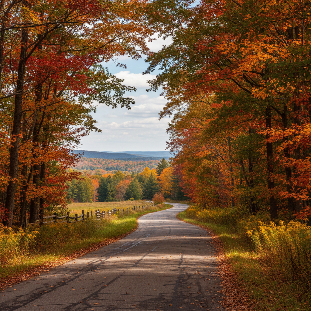
The Gatineau Hills Loop: Chelsea to Wakefield
Distance: About 80 kilometres round trip. Drive time: 1.5 hours without stops.
Cross into Quebec via the Champlain Bridge or Portage Bridge, then take Highway 5 north toward Chelsea. Exit at Old Chelsea Road and wind through the village, stopping at Les Fougeres for lunch (reservations are a good idea) or Chelsea Pub for something more casual.
Continue north on Highway 105 to Wakefield. The drive follows the Gatineau River valley, and the hills rise on either side. In fall, this stretch is spectacular, with maples and birches turning orange, red, and gold. Wakefield itself has the covered bridge on Mill Road, Biscotti and Co. for coffee, and the Wakefield Mill if you want a more refined meal or a spa visit.
On the return, take Highway 366 east to reconnect with Highway 5, or continue north on Highway 105 toward Kazabazua for a longer loop through deeper bush country. The road north of Wakefield is quieter and wilder, with fewer services but more dramatic scenery.
For a detour, turn into Gatineau Park at the Chelsea entrance and drive the parkway to the Champlain Lookout. The views from the top stretch across the Ottawa Valley and are particularly stunning at sunset.
Best season: Early to mid-October for peak fall foliage. Summer for swimming stops along the Gatineau River.
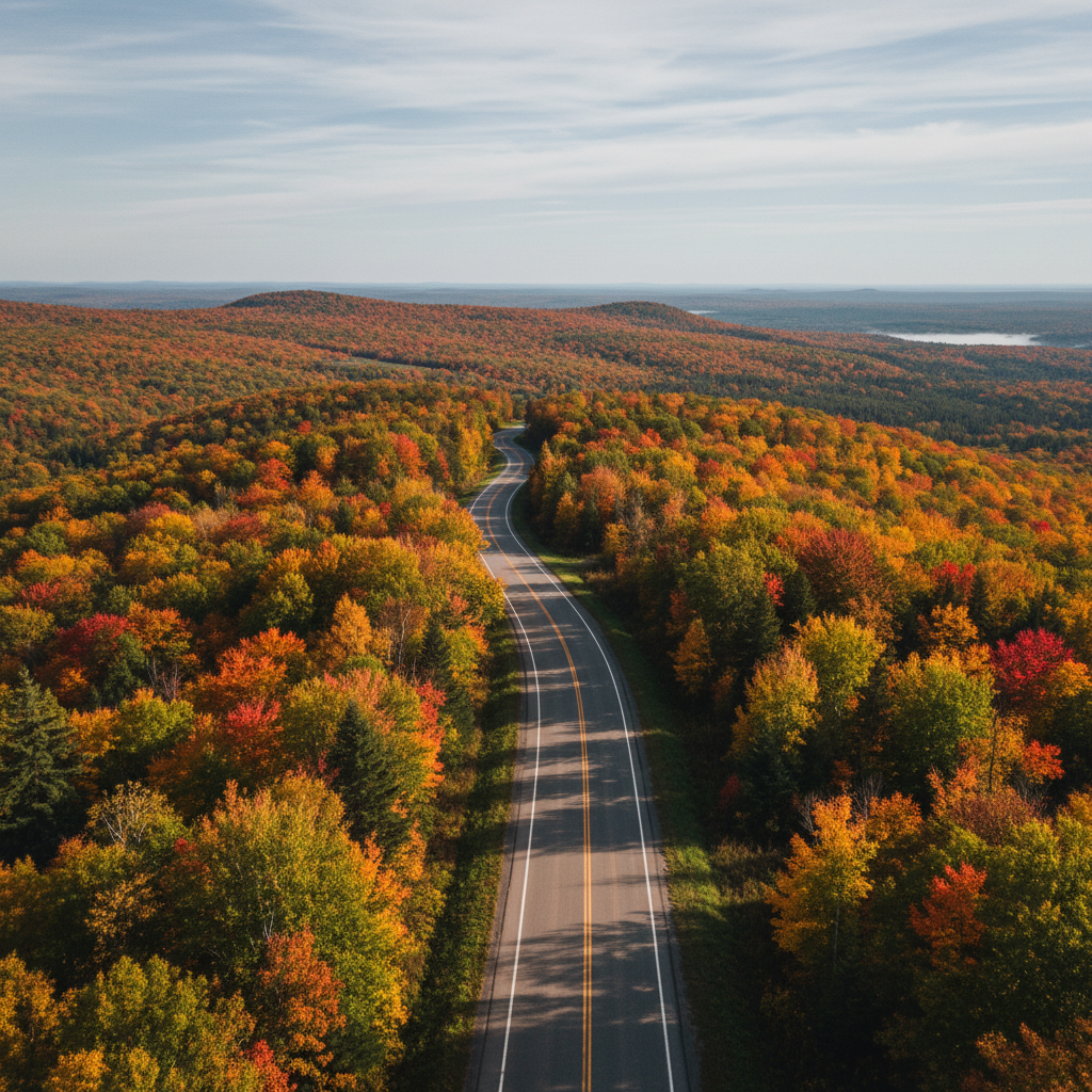
The Ottawa Valley Run: Ottawa to Arnprior and Calabogie
Distance: About 140 kilometres one way to Calabogie. Drive time: 1.5 hours without stops.
Take Highway 417 west from Ottawa, then exit at Arnprior, about 50 minutes from downtown. Arnprior sits where the Madawaska River meets the Ottawa River, and the waterfront park has picnic tables and a boat launch. The John Street Cafe downtown does a good lunch.
From Arnprior, drive south on County Road 508 through Pakenham, where the five-span stone bridge over the Mississippi River is the only one of its kind in Ontario. It was built in 1903 and is worth a stop and a photo. Continue south to White Lake, then west on Highway 511 to Calabogie.
Calabogie sits on Calabogie Lake at the edge of the Canadian Shield. The landscape shifts noticeably here, from flat farmland to rocky, forested terrain. The Calabogie Lodge on Barrett Chute Road is a good spot for dinner or an overnight stay. In summer, the lake offers swimming, canoeing, and fishing. In winter, Calabogie Peaks ski resort has downhill skiing with views over the lake and valley.
Best season: Year-round. Summer for the lake, fall for the drive, winter for skiing.
The St. Lawrence Route: Ottawa to Upper Canada Village
Distance: About 115 kilometres one way. Drive time: 80 minutes without stops.
Take Highway 416 south from Ottawa, then Highway 401 east to Morrisburg. The drive itself is mostly highway and not particularly scenic, but the destination makes up for it.
Upper Canada Village is a living-history museum on the St. Lawrence River, recreating life in an 1860s Ontario village. Costumed interpreters run the shops and farms, and the level of detail is impressive. Budget about 3 hours for a full visit.
On the way back, take the scenic route along County Road 2, which follows the St. Lawrence River through Iroquois and Cardinal. The road passes through quiet farming communities and offers views of the river and the American shore. Stop at the Iroquois Lock to watch ships pass through the St. Lawrence Seaway.
If you have time, continue east to Brockville, where the heritage downtown on King Street has restaurants, a waterfront park, and the Brockville Railway Tunnel, Canada's first railway tunnel, now open as a pedestrian attraction with a light show.
Best season: May through October when Upper Canada Village is open. Fall colours along County Road 2 are excellent in late September.
The Mississippi River Loop: Almonte to Perth
Distance: About 130 kilometres round trip. Drive time: 2 hours without stops.
Take Highway 417 west to the Almonte exit (County Road 49) and head south into town. Almonte sits on the Mississippi River and has a walkable main street with Heirloom Cafe, Baker Bob's bakery, and Mill Street Books. Walk the riverwalk past the waterfalls, then drive south on Highway 29 to Perth.
The road between Almonte and Perth passes through open farmland with views of the river valley. Perth's downtown is well preserved, with limestone buildings and a main street anchored by The Perth Pie Co. and Fiddleheads restaurant. The town park along the Tay River has walking paths and, in summer, paddling access.
For the return, take Highway 7 east back to Ottawa, or extend the loop south to Rideau Ferry, where a small bridge crosses the narrows between Big Rideau Lake and Lower Rideau Lake. The views from the bridge are lovely, and the Rideau Ferry Yacht Club sometimes has a patio open in summer.
Best season: Late September for fall colours. Summer for river activities and patios.
Practical Tips
Fill your gas tank before leaving Ottawa. Several of these routes pass through areas where stations are spaced 30 to 40 kilometres apart. Bring water, snacks, and a paper map or download offline maps for areas where cell service drops, particularly on the Calabogie and Wakefield routes.
Most of these drives work as half-day or full-day trips. The Rideau Canal route and the Ottawa Valley run are long enough to justify an overnight stop, particularly in Perth or Calabogie. For overnight options, see our easy getaways guide.
For families, the St. Lawrence route and the Rideau Canal route have the most structured stops. For couples or solo travellers, the Gatineau Hills loop is the most atmospheric. For a broader overview of what is within reach, check our small town escapes and family day trips guides. And if you prefer to stay in the city, our quiet Ottawa guide covers neighbourhoods that feel like an escape without leaving town.